Water Quality Analysis at LTER in Cape Fear River Basin
Project Summary
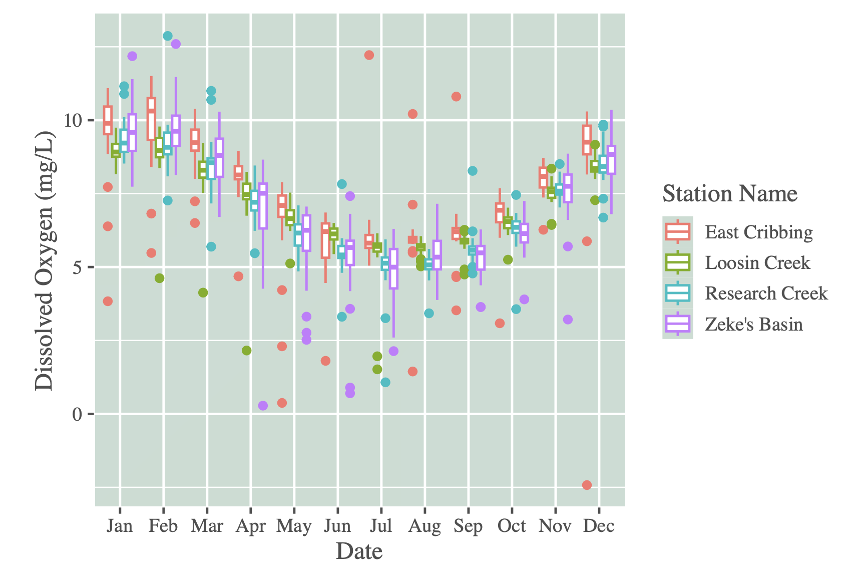
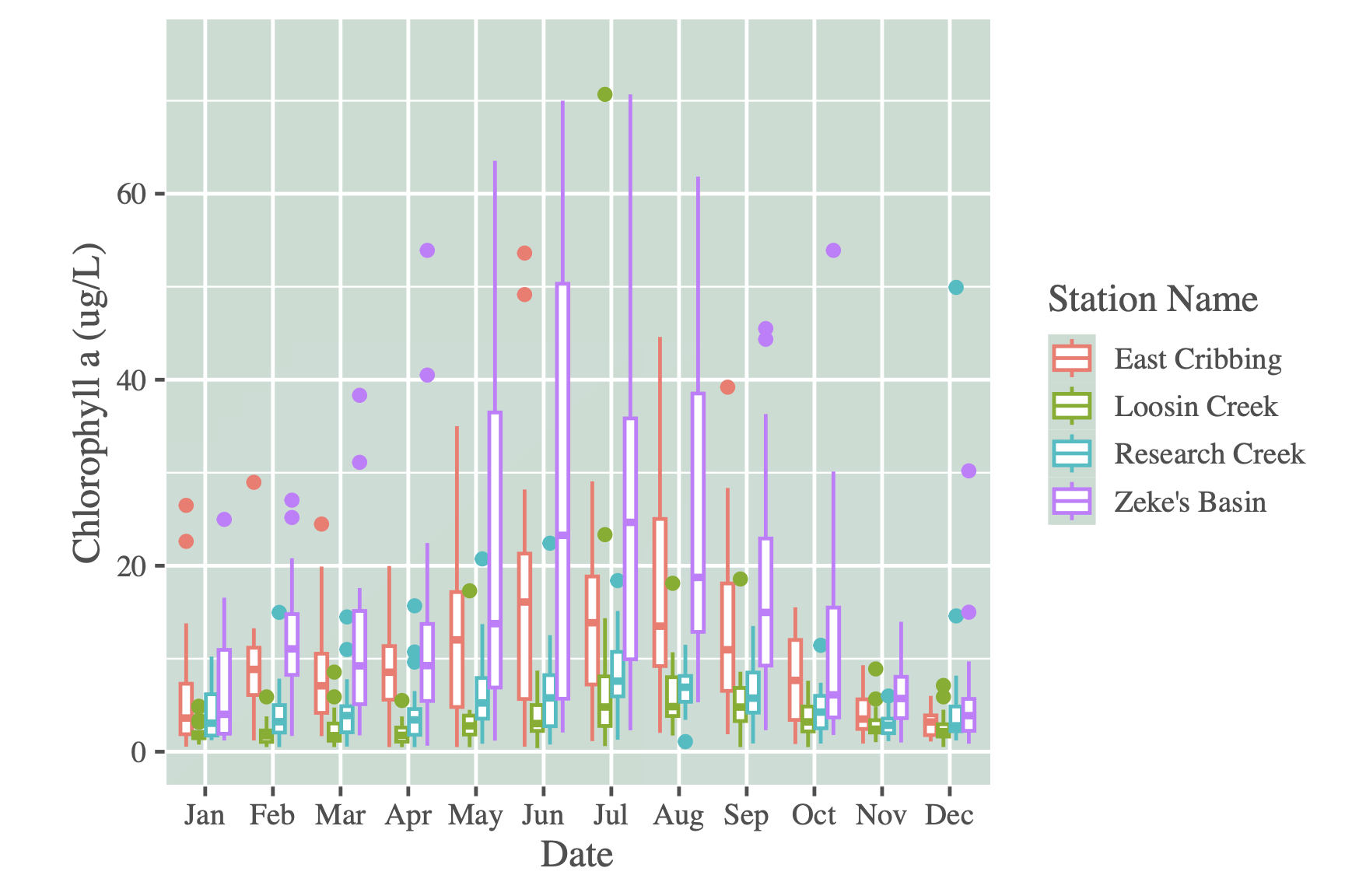
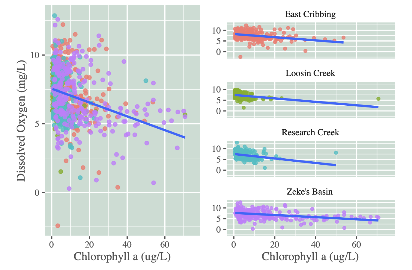
In the final project for Environmental Data Exploration, my teammates and I analyzed the relationship between dissolved oxygen, chlorophyll, and other nutrients at an LTER in the Cape Fear River Basin. We performed a multiple regression and time-series analyses to determine significant relationships between variables of interest. We had two main research questions.
- Has there been significant statistical trends in the dissolved oxygen and chlorophyll a concentrations at the water quality monitoring stations over time?
- Which water nutrient variables are most strongly predictive of dissolved oxygen and chlorophyll? Have these strongly predictive variables had significant statistical trends in their concentrations at the water quality monitoring stations over time?
In our analyses we found that wildfire-burned areas is a significant driver of higher AQI across California. In Los Angeles, more burned area leads to more unhealthy air quality days (AQI > 100). And finally, social vulnerability is linked to higher baseline AQI but does not change the wildfire–AQI relationship.
The full report is linked below.
Project information
- Category Environmental modeling
- Class Environmental Data Exploration
- Date December 2025
- Github Repository